EXTREME NORTHLAND
Home | PHOTO GALLERY | The beautiful town I live in | STORM VIDEO | A brief bio about me | WEATHER HEADLINES | SEVERE WEATHER OUTLOOK | Photo of ice on Lake Superior | Feb. 2-4, 2003 snow event | Storm Alley | My Storm Spotting Experiece so far... | Significant northland events | '

radtttttmotuion.gif

SEVERE STORMS OF THE NORTHLAND

vortexalexlogo.jpg

My new home page

winter storm video clips

sirensatillite2.gif

lightning1.gif

lightning4.gif

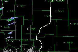
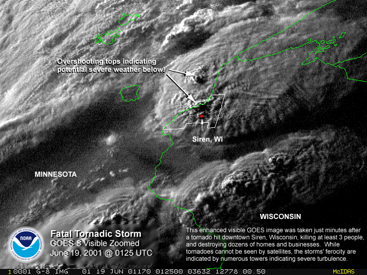
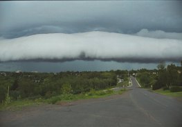
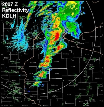
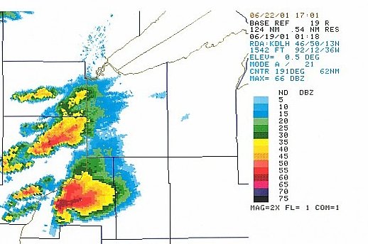
RADAR SHOT OF THE JUNE 18, 2001 SIREN SUPERCELL/TORNADO. LOOK AT THAT HOOK ECHO!!!!! THE NORTHERN SUPERCELL 29 MILES SW OF DULUTH ALSO HAD REPORTS OF TORNADOS.

ref3.jpg

lightning5.gif

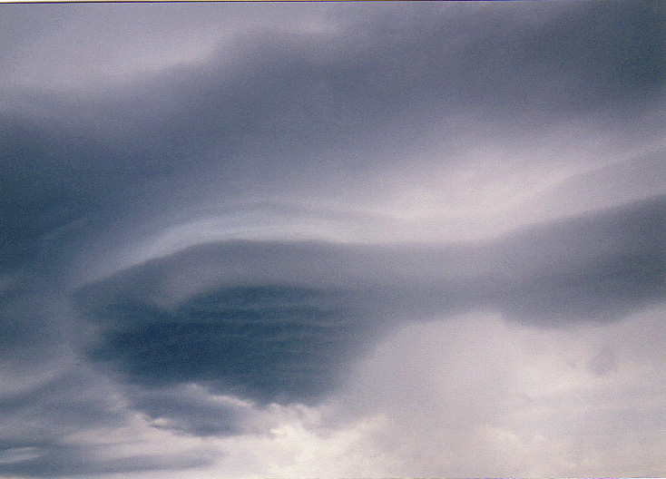
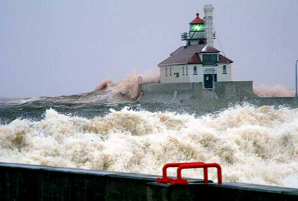
There is a large varaity of severe weather in the northland. From winterstorms, to thunderstorms, to storm force winds on lake superior to even icestorms. This website is the place to be when severe weather strikes! This site is still being worked on and won't be complete for a few months, but I will update the severe weather outlook every day or so.

My other Skywarn partners, Aaron DeBaiso and Chris Little.

CHRIS'S NEW WX SITE

lenticularclose.jpg

I NEED TO HEAR FROM FELLOW STORM BUFFS!
 

ON JULY 14, 1998, A MASSIVE SHELF CLOUD PASSES THROUGH DULUTH/SUPERIOR, PRODUCING 40MPH WINDS AND SMALL HAIL.

roll7.jpg


LINKS


DULUTH HAZORDOUS WX OUTLOOK

Storm Trax

WEATHER TAP

SKYWARN

Storm chasing raw wx data

STORMCHASE.US

Minnesota apr-weather

Storm Chaser Dirk Miller

WEST DULUTH STORM CHASER

The Twin Ports LWS (local weather serices by Chris Little.)

Models

NWS Duluth

Current watches

Mesoscale Discussions

Convective outlooks

Twin Ports radar

Midwest Visible satellite image (day time only)

lightning1.gif

September 2 2002
2007_z_dlh.jpg
The bow shaped line of storms to the top in Bayfield county earlier hit Duluth with 2 inch hail

GET READY. SEVERE WEATHER SEASON IS ALMOST HERE!

.

NOVEMBER 27 2001: GIANT WAVES IN THE DULUTH SHIPPING CANAL! PICTURES HERE!

NOVEMBER 27-2001
wave1.jpg
www.duluthshippingnews.com